When talking about Raven Rock State Park in Harnett County, North Carolina, the Cape Fear River will always find its way into the conversation. That’s because this important river halts the state park on its way to the coast.
That important body of water is one of many things about this place that makes it one of our favorites to go hiking in North Carolina, and we’re in no way alone.
Consider just how popular this park gets on weekends and holidays, as much of the crowd heads here for a look at the river from the Overlook or down to the bucket list-worthy (and namesake) Raven Rock, and you’ll see what I mean.
Of course, a wealth of other recreational fun awaits, including fishing, camping, and even some boating. If you’re looking to visit Raven Rock State Park or reminisce about your favorite public space with us, our guide will share all that you can do here, along with contact info and personal tips to help you enjoy it most.
Here’s how we’ve organized this guide if you’re looking for something specific:
- Raven Rock State Park Facts
- Visiting Raven Rock State Park Today (+ Address)
- Things to Do
- Nearby Places (Lillington and More!)
You can scroll ahead or keep reading about some interesting Raven Rock State Park facts.
Read More: Outdoor Activities in North Carolina

Facts about Raven Rock, North Carolina

Like Medoc Mountain to the north, Raven Rock rests near the fall line. Millions of years ago, heat and pressure built the underlying structure, which is harder rocks reminiscent of the foothills meeting the adjacent soft, coastal pain-similar ones.
Winds and water carved up and eroded much of the land that we recognize today when hiking through today’s park. The 150-foot-tall Raven Rock remains and towers over its surroundings by the Cape Fear River.
Prior to European arrival in the 1700s, this area was the home and hunting land of the Siouan and Tuscarora people. For many years, the Raven Rock was named Patterson’s by an early settler but eventually earned the current moniker due to Ravens being spotted at its top.
Read More: The NC Bucket List Book
Visiting Raven Rock State Park Today
Address: 3009 Raven Rock Rd, Lillington, NC
Official Website

Raven Rock was a prominent landmark for boaters during the Cape Fear River’s heyday as a ferry route. However, damage to dams and locks from a devastating hurricane in 1859 and the rise of railroads took industrial attention away from there.
Its rise as a recreation spot eventually led to public interest in preservation, and in 1969, the North Carolina General Assembly established Raven Rock State Park in North Carolina. The original 400 acres have grown to today’s 4,684, with plenty of room for all to explore.
Weekdays are best for coming and enjoying the park, as weekends tend to get very busy. Each weekend, Raven Rock is among the first. By mid-morning, we’ll see the NC State Park’s social media pages (Twitter, for example) included in its list of full parks.
That’s why I suggest you plan accordingly when you decide to visit.
Read More: Our Favorite Scenic Roads in North Carolina
Things to Do
Whether you come with no plans or have everything already mapped out, Raven Rock State Park is ready with plenty of things to do. We come primarily to hike but have also enjoyed a few picnics here.
Others love this park for horseback riding, mountain biking, camping, fishing, and more.
Read More: 50+ Easy Day Trips from Fayetteville (Great Getaways!)
Hiking
Raven Rock is a great day trip from Raleigh and Durham in the Research Triangle and Greensboro, so we often travel here for hiking. Here are all the paths on the trail and a little about why we like them.
Note: Some Raven Rock State Park trails may be closed due to weather or construction, so please call ahead before visiting. Maps can typically be found at the visitor’s center and trailheads, but this one is available via the park’s website.
American Beech Trail (TRACK Trail)
Trail Length: 0.5 Mile Loop (White Circle Blaze)
The American Beech Trail is Raven Rock’s TRACK trail, with a mix of boardwalk and natural surfaces for the whole family to enjoy. This trail starts at the right-side access from the day-use parking lot with the picnic area.
Read More: 15 Great Things to Do in Beech Mountain (+More Nearby!)
Campbell Creek Loop Trail
Trail Length: 4.5 Mile Loop (Blue Circles)

Other than the bike-friendly Mountain Laurel Loop Trail, Campbell Creek might be the most challenging hike in this park. There is some incline along the way but the scenery along the way makes this one absolutely worth the journey.
You’ll see the Cape Fear River and access to the Lanier Falls Trail, which we’ll mention shortly.
Cottonwood Trail
Trail Length: 0.4 Miles (Orange Triangles)
Accessed via the Little Creek Loop Trail along the Raven Rock Loop, you’ll cross creeks and bridges during this short hike.
Fish Traps Trail
Trail Length: 0.6 Miles (Blue Triangles)
When starting on the left side of the Raven Rock Loop, you’ll have the option of veering off toward the Fish Traps Trail. Here, you’ll find the Northington Lock and Dam remnants that the 1859 hurricane damaged.
Many folks come here to fish, so bring your reel if you have one!
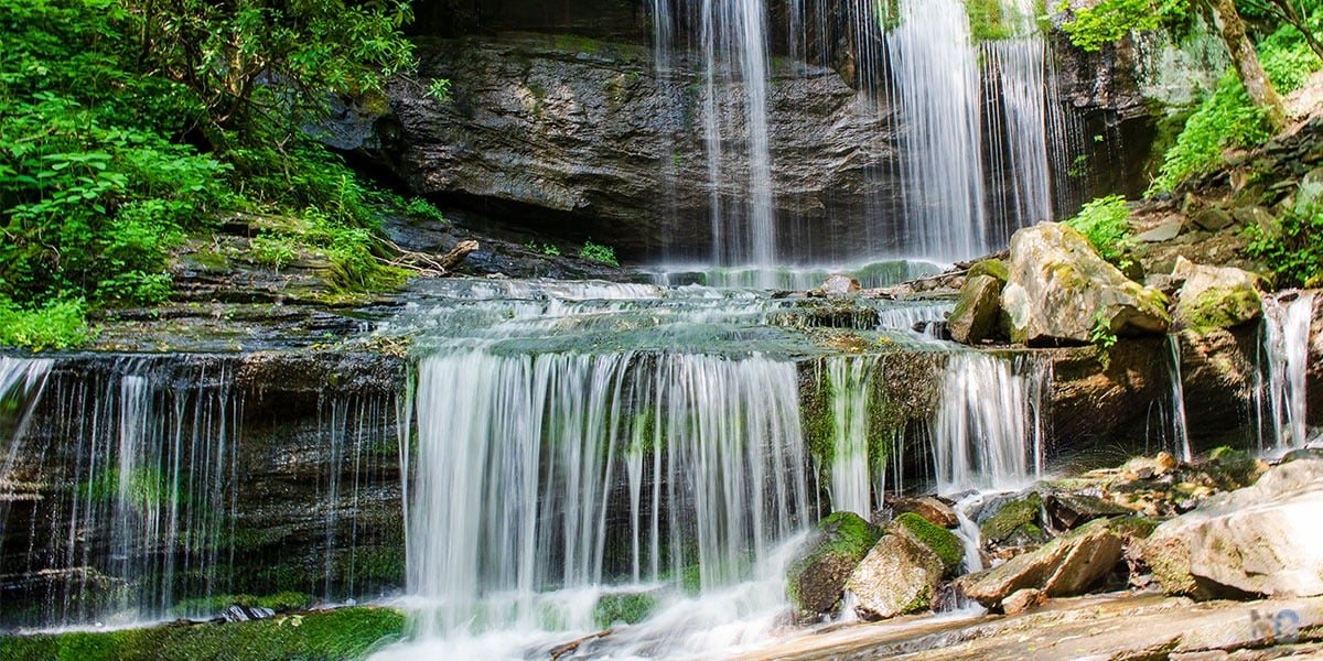
Lanier Falls Trail
Trail Length: 0.2 Miles (Orange Triangles)

Lanier Falls Trail is a Campbell Creek Loop offshoot, and the scenery varies depending on river levels. While not technically a waterfall, as you’ll find in Western North Carolina, this is more about its position on the fall line.
If the river is just right, you’ll see the Cape Fear River’s rapids, contrasting the slower-moving section down at the Raven Rock Falls.
Read More: 20+ Kid-Friendly Waterfalls In NC (Easy Hikes And Swimming Holes!)
Little Creek Loop Trail
Trail Length: 1.5 Mile Loop (Blue Hexagons)
Little Creek Loop Trail is a Raven Rock offshoot that’s a nice add-on. You’ll walk along the creek under trees and eventually meet the Raven Rock Loop near where the latter’s incline begins.
Longleaf Loop Trail
Trail Length: 0.2 Mile Loop (Red Hexagons)
The Longleaf Loop Trail is Raven Rock’s only accessible trail directly behind the visitor center. It’s tree-covered and offers exhibits on local wildlife, as well as the work done by conservationists and natural resource managers.
Northington Ferry Trail
Trail Length: 0.9 Miles (Orange Triangles)
Northington Ferry Trail is on the same side as Fish Traps and is another popular fishing spot. The trail is named for the family who once operated the ferry system that passed through the area, as well as a general store and nearby lock and dam.
Raven Rock Loop Trail
Trail Length: 2.6 Mile Loop (Orange Circles)


The park’s namesake trail is easily the most popular for at least a couple of significant reasons. Along this trail, offshoots such as Little Creek and Fish Traps present themselves, but if you keep going, you can choose between the Raven Rock and the Overlook that stands above the Cape Fear River and its surroundings.
I prefer descending down to the Raven Rock for a look at the riverbed and the boulders that tower over it. You can then climb back up the stairs and get back on the loop toward the Overlook, which is awesome on clear days.
Personally, I think you get a clearer look at the river and its surroundings in late fall through winter. However, the view might be more obstructed from spring through early fall, but the area is much greener.
Read More: 25 of the Most Amazing Winter Hikes in North Carolina
Mountain Biking Trails
The Mountain Laurel Loop Trail is actually three different trails broken down into three skill levels. As with the hiking and bridle trails, please contact the park before visiting because weather and construction could close these trails.
- Beginner (6.6 Mile Loop, White Squares)
- Intermediate (2.6 Mile Loop, Blue Squares)
- Advanced (4.3 Mile Loop, Red Squares)
Bridle Trails
There are two bridle trails at Raven Rock State Park accessible via the Avents Creek Access off SR 1418.
- Bridle Trail – East Loop (4 Mile Loop, White Circles)
- Bridle Trail – West Loop (4 Mile Loop, Red Circles)
When there have been heavy rains in the area, these trails may be closed to help preserve the area for future use. Please contact the park in advance before visiting.
Paddling

You can paddle along the Cape Fear River and through the park’s rapids of Lanier Falls and Fish Traps. However, there’s no access point to Raven Rock State Park via boat.
For more info about the official Cape Fear Canoe Trail, which runs for 56 miles and through parts of Raven Rock, check the Cape Fear River Adventures website.
Picnicking
A large picnic area at the parking lot is just past the park’s main entrance. More than 25 tables and eight grills sit in a tree-covered area, with restrooms and water fountains nearby.
Raven Rock’s picnic shelter has eight tables, with two accessible ones. Up to 50 people can be accommodated for gatherings. The park strongly suggests reservations due to the shelter’s popularity.
Camping
Raven Rock State Park has a couple of locations for camping, and most are inaccessible by vehicle. Amenities vary, but all have a vault toilet and a fire ring with a grill.
- Family Wilderness Camp holds five campsites about 2.5 miles from the parking lot off the Campbell Creek Loop Trail. A maximum of six campers is allowed per site.
- Canoe Camp is accessible either via the Little Creek Loop Trail, about 1.7 miles from the park office, or via paddle-in along the Cape Fear River Canoe Trail. A maximum of six campers is allowed per site.
- Moccasin Branch Campground has 6 camper cabins, 15 tent and trailer sites, and 9 RV camping spots (with full hook-ups).
Note: Camping is by reservation only.
Fishing
We mentioned a few hiking trails that double as popular fishing spots. Many folks come to Raven Rock State Park for a chance to catch bass, catfish, sunfish, and others.
You can fish here only during the park’s open hours and must have a North Carolina state fishing license. NC Wildlife Resources Commission regulations are enforced here.
Nearby Places to Visit
Lillington
Lillington to Raven Rock State Park: 9 miles (12 minutes)
The park’s address is listed as Lillington, but the town is a little more than 10 minutes away. People coming from places to the south or east, like Fayetteville, will pass through here. If you still need to load up on food and supplies, this is the last place to get that done.
Sanford
Sanford to Raven Rock State Park: 19 miles (26 minutes)

People driving from Raleigh and Durham (okay, Chapel Hill, too!) will either travel down US-1 or US-401. Sanford is the last major town you’ll pass.
There are quite a few places to stop, and personally, I think some barbecue from Stubbs & Son off US-1 is the way to go after hiking. You can thank me later.
Benson
Benson to Raven Rock State Park: 26 miles (35 minutes)
And if you’re coming from the north via I-95, Benson is the last major town you’ll pass before Raven Rock. That Johnston County town is home to one of our favorite distilleries (Broadslab).
We’re in no way promoting drinking and driving, but you can always take a bottle of their amazing farm-to-distillery spirits home to savor later!
Ready to Enjoy Raven Rock State Park?

And speaking of something to savor, how about those memories of Raven Rock after visiting this awesome state park? If you haven’t been yet, I hope you’re within driving distance and can make it happen immediately.
Now, if you’ve been lucky enough to hike around this place, we’d love to know your favorite things about it. Is it the Overlook? What about the Raven Rock? Perhaps it’s Lanier Falls or something else?
Regardless, we’re always eager to talk more about Raven Rock State Park and hope you enjoy it as much as we do.


Hey, Raven Rock added an RV friendly campground called Moccasin Branch a couple years ago. It’s on the same side of the river as the visitor center and is very nice. You’ll want to make your reservations in advance since it often is booked. There’s access to the main park and bike trails from the campground.
Thank you for this informative article. Raven Rock was my Father’s playground as a child, before it became a state park. I an wondering, though why is Benson mentioned as the last major town you pass through if approaching Raven Rock from the north via I-95? What about Dunn?